Hi all,
As it’s now possible to download a CSV export of d-portal’s activity point locations, I thought it would be worth discussing using this data for geospatial analysis.
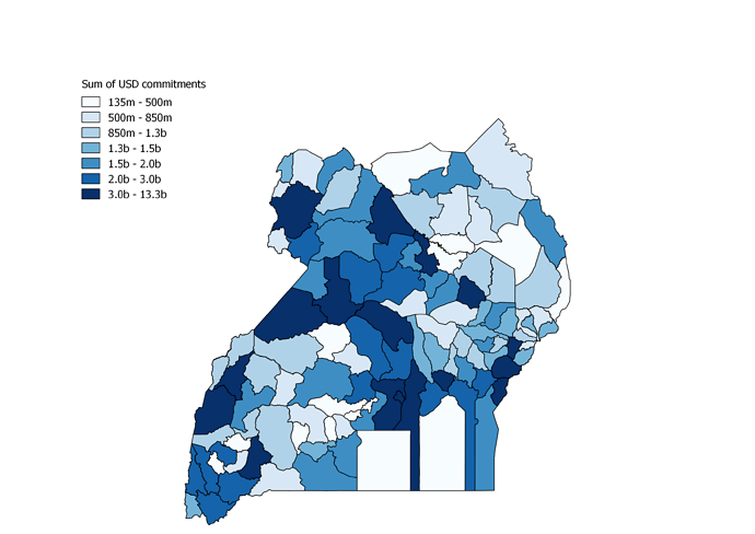
First stab was a naive point-in-polygon operation with the Ugandan district shapefile we’ve been using for the DI Datahub. This was done via the “Join attributes by location” function in QGIS, and allowed attaching the district names to the d-portal data here: joined_points.xlsx (845.7 KB) And can be aggregated by the district here: joined_point_sum.xlsx (12.4 KB)
From there, you can re-join the sums to the original districts to put together a choropleth, e.g.
Points for discussion at the moment:
-
Figuring out a method to determine the geographic scope of the points in d-portal. A lot of geocoded projects probably just sit at the center points of the nation and should be split equally rather than being aggregated into whatever district sits in the geographic center.
-
Figuring out a method to split single financial transactions across multiple locations.
-
Whether once we figure out the above, the distribution of the financial allocations will be meaningful. What would the caveats be about incomplete or biased data.
Happy to hear your thoughts on the case study above, or what you might think is possible with this data.
Cheers!

